Saturday, April 12, 2014

Not the best day to finish

This is the last Blog for the Glen Coe area this season, we will start forecasting again in December. Lochaber and North Cairngorm will issue forecasts over the Easter week-end. Thanks for supporting the service have a great summer.

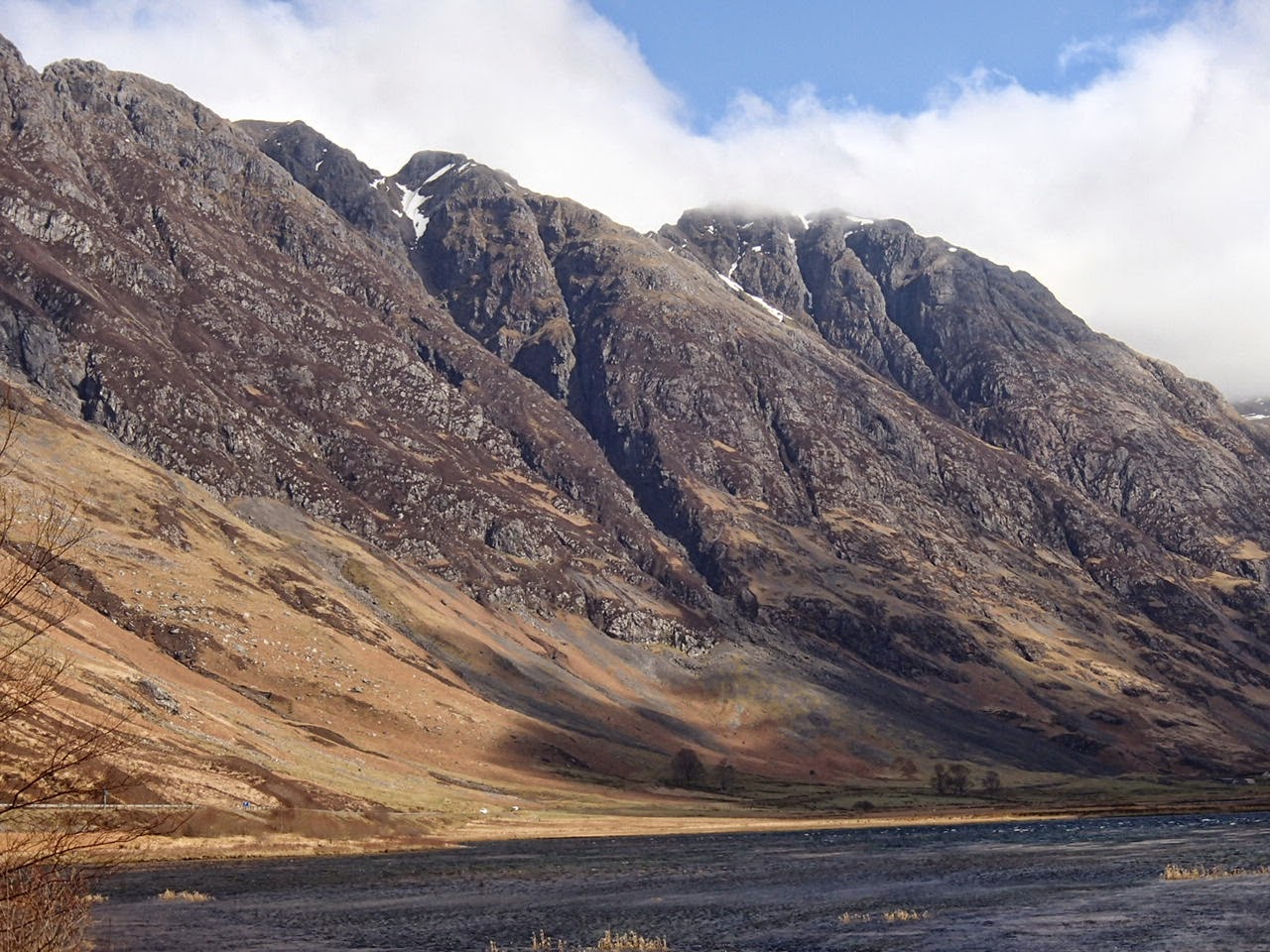
unfortunately the season did not end on such a good day but a nice reminder of whats to come next winter

Overnight some light snow fell above 950 metres, during the day precipitation fell mainly as rain with some sleet on occasions at summit level. The winds have been strong from a Westerly direction and the freezing level was above the summits. Some pictures through the glen today.


Friday, April 11, 2014

Bright at first


Overnight, the freezing level fell to 800 metres and became 1100 metres by mid-day. Precipitation became more frequent and persistent as the today progressed. There were light snow showers above 850 metres and the winds were fresh from the West-South-West and strengthening by mid-day.


Meall a Bhuiridh 

in and out of the clouds rain below 900 metres

Buachaille Etive Mor the snow almost gone on this North-East aspect

looking towards Glen Coe

Stob Coire nan Lochan


Thursday, April 10, 2014

Sunshine and showers - some snow

Isolated showers with the odd snow flurry above 900 metres but predominately dry. The freezing level was just above the summits and the winds were fresh from the West-South-West. Spring like weather in the glens.
snowing - briefly at 1000 metres

thanks to Mountain Equipment

Snow flakes today


Wednesday, April 09, 2014

Thaw conditions

Snowpack is moist, soft and diminishing quickly below 800 metres its more extensive above this altitude and slightly more compact. Poor visibility today with rain at all levels. The winds were strong from a Westerly direction.


rivers and streams in spate from rain and snow melt


Tuesday, April 08, 2014

Lambing snows

Strong Westerly winds with precipitation that fell as snow above 650 metres with rain at lower elevations. The freezing level started out at about 800 metres rising to around the summits by late afternoon.
one of the brighter spell today

new snow being transported on the strong Westerly winds

Snowpack is soft and diminishing below 800 metres more extensive above this altitude which is generally compact, firm over the summits. Clear spells in the morning with poor visibility in clouds at times in the afternoon. Strong Westerly winds.

Monday, April 07, 2014

Dry and fairly clear.

It has been dry through the period with the freezing level just above the summits. The winds were light from the South. Its the first day with views for about a week.

looking across to Clach Leathad


deep glide cracks appearing

looking towards the Ben Nevis


the shoulder of Creise then summit of Stob Dearg


Sunday, April 06, 2014

Saturday, April 05, 2014

Another damp misty day


Rain through most of the day. Thawing patches of snow below 650 metres good cover of snow above 800 metres. Very poor visibility all day above 500 meters. Fresh Southerly winds 10 mph.


The 3 sisters

Aonach Eagach

looking into Stob Coire nam Beith


Rain and mild conditions will prevail with the snowpack diminishing. Cornice collapse, ice and rock fall are hazards during these thaw conditions. Cornice collapse is independent of avalanche hazard.

Friday, April 04, 2014

Rain and poor visibility

Persistent rain through the morning, drier after mid-day.  Thawing patches of snow below 650 metres good cover of snow above 800 metres. Very poor visibility all day above 500 meters. Fresh South-Easterly winds 7 mph.

a fleeting glimpse this morning through the rain of Stob Coire nan Lochan and Stob  Coire nam Beith


it remained cloudy for most of the day

Gearr Aonach and Aonach Dubh

Thursday, April 03, 2014

Damp and cloudy


Mainly dry below cloud level but damp within clouds with an odd isolated rain shower. Thawing patches of snow below 650m good cover of snow above 800 metres. Poor visibility all day above 500 meters. Fresh South-Easterly winds 14 mph.


Buachaille Etive Mor

Meall a Bhuiridh and Sron na Creise

Wednesday, April 02, 2014

Another misty start.

Dry today - with patches of snow below 650m with good cover of snow above 800 metres which is firm in places above 950 metres. Poor visibility during the morning above 700 meters - conditions improved in the afternoon will brighter spells. South-Easterly winds 10 mph which felt fresh at times.


thawing snow in the mist

some localised hazards!

poor visibility here during the morning above 800 metres

clearing slightly over Stob Coire nam Beith

Aonach Eagach with cloud on the summit of Am Bodach.

Note: very little snow on Southerly aspects.

Tuesday, April 01, 2014

Misty morning

distinctive cloud base

looking towards Glen Coe

localised surface wet snow slides and rock fall

riming & new snow at 930 metres

Glen Coe and the 3 sisters this afternoon.